Photo Album Index
"Bearing Orchard", 1910 postcard, ranch of Mrs. Julia Cook; promotional for Steven's Studio, Opp. Russell Hotel. Courtesy of Art Beal - Thanks for sharing!
Historic Emmett Alley Signs, courtesy of Madonna Colburn. Thank you for sharing! See discussion on Preserving Emmett's History facebook group
Historic Emmett Main Street signs, courtesy of Madonna Colburn. Thank you for sharing!
E. E. Hunt, store and residence, courtesy of Art Beal. Thank you for sharing!
Burdge Mill Grist Stones
1910, Emmettsville revised plat, 24 February 1900
Thunder Mountain Stages postcard
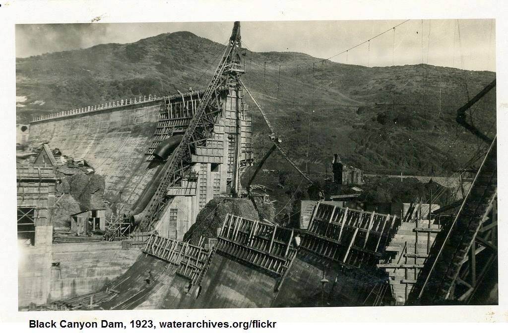
1923-BlackCanyon Dam (from waterarchives.org)
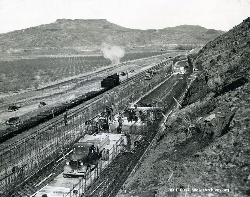
1930's, Black Canyon Canal construction (from waterarchives.org)
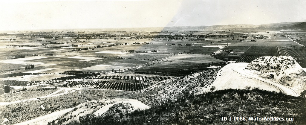
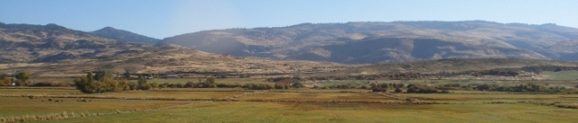
1930's, Emmett Valley (from waterarchives.org)
1933, 3rd Fork CCC's Camp, courtesy Art Beal, thanks for sharing!
1940 Emmett Orchard (from waterarchives.org)
Herbert Day, 1940's
Tom Curtis, 1944, Montour
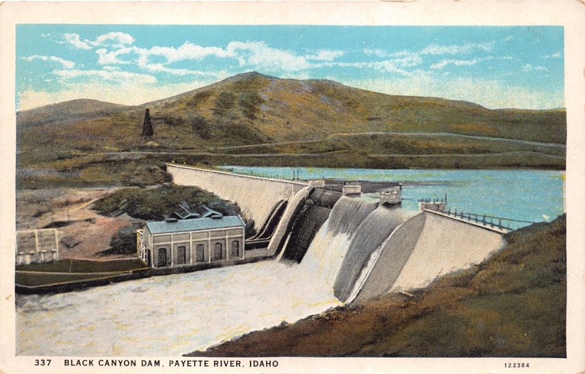
Black Canyon Dam postcard
Montour Photographs From Library of Congress
Ola Self-help cooperative (Farm Security Administration) From Library of Congress
Pearl Photographs
Book 1, page 33 map showing old Boise/Canyon county line and Westview Mining District (Pearl). The map was filed in Canyon County Oct. 27, 1897, at 3 PM and certified Nov. 11, 1915 when we became Gem County. (Thanks to John Henderson for verifying the dates!)
Pearl 1902
Reconstructed Map of Pearl 1902
Pearl Class 1909, Commencement Program
Sweet Photographs
Ballantine Wool Wagons at Sweet water trough
Sweet Methodist Church with history by Kennie Klingback
Sweet School, c. 1900
Sweet Street scene
Sweet -- Talley Store & Woody Hotel, after 1909
Pioneers
Ted Carr Stage from Emmett to Ola and Cascade,
William Cramer's daughters about 1940: Ruth Gross, Isabell Walker, Annie Gross, Robert Zuella Whitlock, Vernie Paddock
Gustav (Jr), Hester and Frank Gross, circa 1910's.
William and Catherine Woody, builder of Woody Hotel, Sweet
Wesley, Dewey and Emmett Woody
Charles W. Thompson, Squaw Creek Homesteader
Henryette Maybelle "Nettie-Mae", 1896
Charles William, wife Isabelle, daughter Nettie Mae, 1897
Charles Harvey, 1900
Charles Harvey and Nettie, 1905
Jack Knife School Students, 1906 (Jack Knife School was roughly three miles south of Ola)
Isabelle and Charles H., 1911
Wheat Harvest on Squaw Creek Ranch, 1915
Looking east across Squaw Creek Valley, from approximate location of Thompson Homestead
War Memorials
WWI, Korean & Vietnam War Memorial at tank in front of courthouse WWII Memorial at tank in front of courthouse
Ephemera
Triangle Service Station, 1938
Gem Creamery Company, circa 1950
Other Photographs
Historical Markers
Shropshire Homestead ("backside of Butte")
Photo Links (off-site)
North Idaho Collection, "The Mike Fritz Collection" of Idaho postcards (includes several Emmett scenes)
Univ. of Idaho Digital postcards
Mountain West Digital Library
Idaho State Historical Society Digital Collections
Virtual Wall, Vietnam Veterans Memorial
familyoldphotos.com for Idaho
Dead Fred Genealogy Photo Archive

|
 |
 |
Copyright © 2009 - Sharon McConnel. All Rights Reserved.